
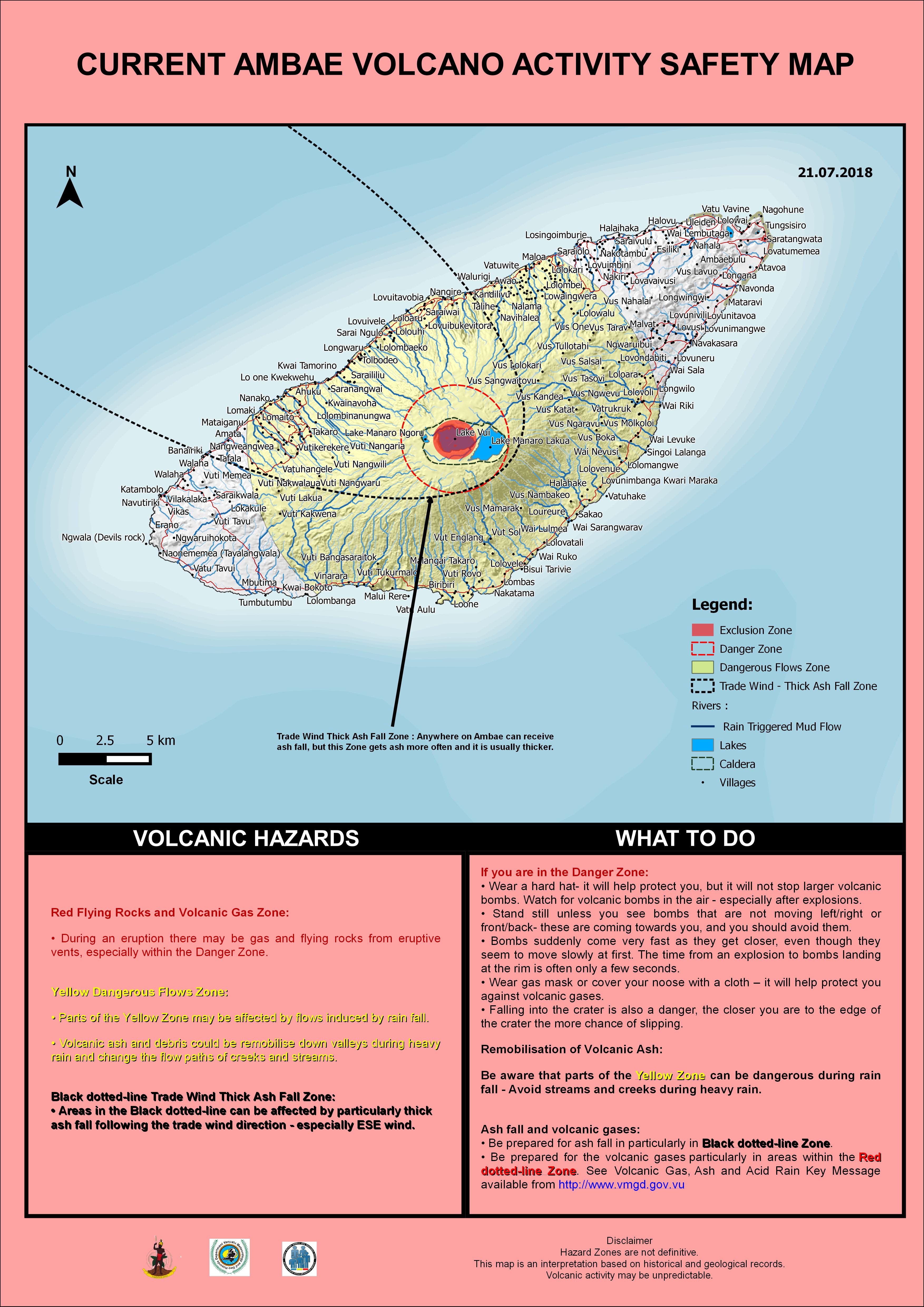
Current Ambae Volcano Activity Safety Map
Ambae, Vanuatu, 2018
Vanuatu Meteorology & Geo-Hazards Department. (2018). Current Ambae Volcano Activity Safety Map 21.07.2018. Government of Vanuatu, Vanuatu Meteorology & Geo-Hazards Department, Vanuatu National Disaster Risk Management Office, New Zealand Foreign Affairs & Trade Aid Programme, GNS Science.
This map was produced by an official agency, but is NOT the most recent, most complete, or main operational map.
For the current operational hazard map, please consult the proper institutional authorities.
Click on image for full-size map. If link seems broken, try the archived version.
Map Data
| Map ID | 3781 |
|---|---|
| Hazard Process(es) | Access or danger zone; Ballistics; Flowage hazards; Gas; Lahars; Lava flows; Tephra fall |
| Hazard Zone Presentation | Hazard level-focused: All or most hazards are combined by hazard level on a main map panel |
| Temporal Scale | Crisis, or short-term, map (hours to decades) |
| Spatial Scale | Island |
| Publication Format | Part of an information statement, bulletin, or other alert product |
| Zonation Method(s) | Geologic history |
| Zonation Model(s) | |
| Scenario(s) Considered | Season or weather; Style or type |
| Hazard Zone Label(s) | Access (exclusion, danger, or safe zones); Hazard process name |
| Probability Definition(s) | No probability definition was discernable from the map |
| Purpose | Crisis management and response: Intended to be used for managing, responding to, and taking action during an eruption; often includes evacuation routes, access restrictions, actions to take, etc. |
| Audience | General public and/or media |
| Language(s) | English |
| Basemap(s) | Hillshade |
| Basemap overlay(s) | Street map |
| Diemsionality | Planimetric (2D or map) view |
| Color Scheme | Red to Yellow |